
|
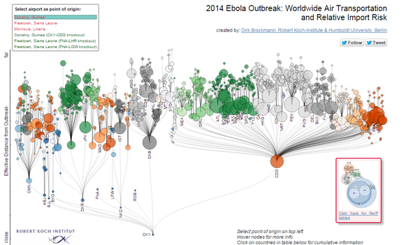 The latest Ebola threat presents a challenge for geographers in trying to understand how it is to be mapped. Media reporting on the topic has been dominated by infographics and maps that show the global map according to traditional geographic mapping, for example the BBC and healthmap.org. These geographical representations of the spread of Ebola are problematic for understanding the spread and risk of the disease. In an international world it seems ineffective to use the traditional state map when dealing with a threat that has little regard for such spatialities. The transport and communication networks that connect us involve a spatio-temporal complexity that makes the spread of diseases and their perceived risk a hugely complex one. In order to fully understand the geography of Ebola, a mapping needs to occur that counters these traditional geographic representations.
0 Comments
|
